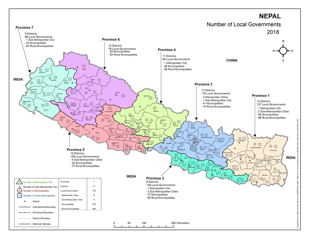
Promulgation of new constitution on 20th September 2015 resulted in the division of Nepal into seven states. The country before was classified into five development regions namely: Eastern, Central,Western, Mid-Western and Far-Western where there were 14 zones and 75 districts.
To decentralize the power and help the nation with sustainable development, the country was restructured after the establishment of federal states which resulted in the change of names and administrative structure of local governments. Former Village Development Committee aka Gaunbikash Samiti has now been replaced with Rural Municipality known in Nepali as Gaunpalika. Also, now the number of districts have gone up to 77 with Rukum and Nwalparasi being split into two each.
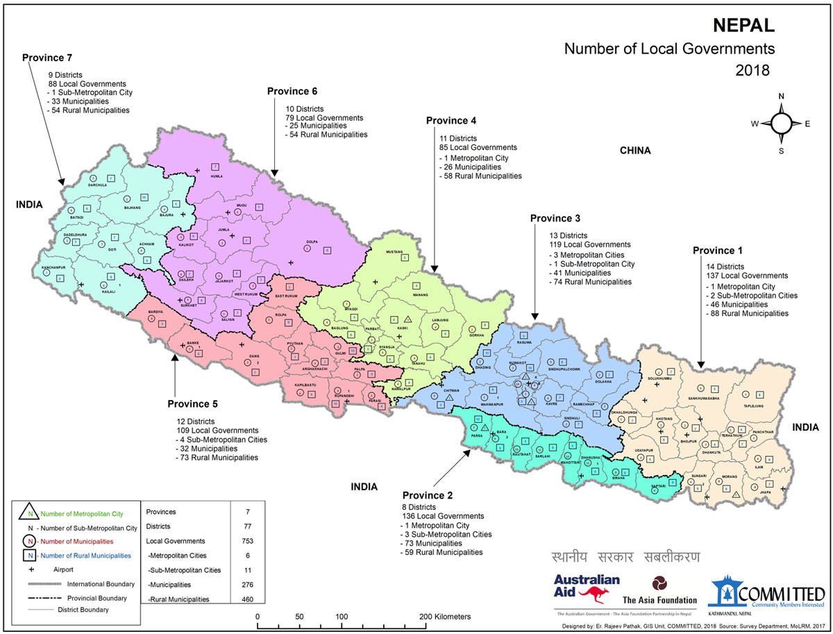
All of that is relevant to COMMITTED’s local governance project we run in partnership with The Asia Foundation. The aim of the project is to improve the internal and external governance and development of its chosen municipalities in addressing service delivery and local economic development. To that end, COMMITTED produces resources that local governments can utilize, such as the map below.
As you can see, the map provides information about the local governments and their structure. The map is probably the first of its kind to be produced in the country since the restructuring.
 Click here for a much bigger resolution of the map.
More maps, of municipalities for example, will be produced and shared with the relevant bodies as well as with the public here in our blog. Be sure to return!
For more, please follow the links below:
Click here to go to a Facebook post of Municipal Round Table Discussion.
Click here to go to a Facebook post of the visit to remaining municipalities.
Click here to read a blog about EnLoG-SDEG.
