In this series of blog posts, we shall be featuring plans and visions of municipalities, COMMITTED is working with in the ‘EnLoG-SDEG’ (Enhancement of Local Governance, Service Delivery and Economic Governance) project.
Bhimeshwor Municipality in Dolakha District of Province 3 is one of the 22 municipalities COMMITTED has been working with since the project commenced last summer. The municipality comprises of 9 wards with a total of 8,639 households.

The municipality is led by an energetic Mayor and has some unique plans and exemplary approach to the generation of Own Source Revenues (OSR). The plans, as the ward chairmen have reinforced, seek to mobilize and take advantage of, as much as possible, locally available resources, both natural and man-made.
At the ward level, a number of wards seek to stimulate its local economy by focusing on and promoting tourism. An ethnic themed museum and home stays has been envisioned in Ward 1 taking advantage of the fact that the majority of the population belong to the Thami caste (an indigenous tribe mainly living in the villages of Dolakha District in East-Central Nepal). Likewise, they hope to promote Ward 2 as a religious and cultural tourist destination owing to its high number of temples. Similarly, Ward 3 and 6 have also been earmarked for tourism development owing to its geography and the existence of hotels.
A number of wards will focus on agriculture-related activities. Ward 4 as agricultural hub and 5 for livestock farming. Taking advantage of its abundance in water sources trout aquaculture farms have been planned for Ward 7. Ward 8 is to be cattle and Kiwi fruit focused, as well as marketing it as a ‘film city’ for the movie productions owing to its scenic location. Finally, potato farming and production of potato chips and other products has been planned for Ward 9.
At the municipality level, the Mayor has envisioned a hydroelectricity plant (Tama Koshi hydroelectric plant) for energy self-sufficiency, along with establishment and promotion of residential schools catering to wealthy families living in Kathmandu Valley for additional job creation and income generation.
In doing all that, Bhimeshwor Municipality is showing how devolution of power from the center and entrusting local bodies to be self-reliant and autonomous could work to bring about growth, development and progress of outlying communities far removed from Kathmandu Valley.
For more on above, please follow the links below:
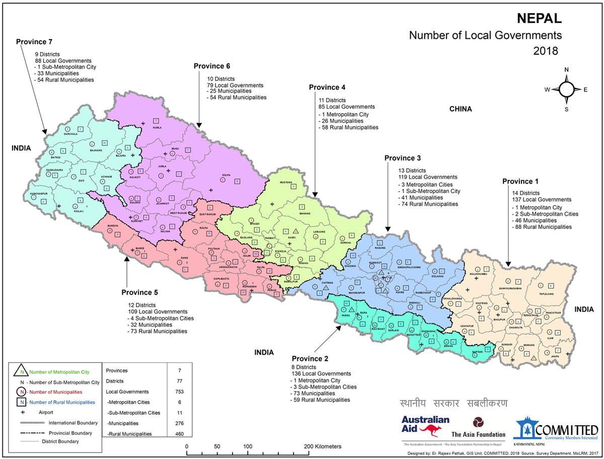
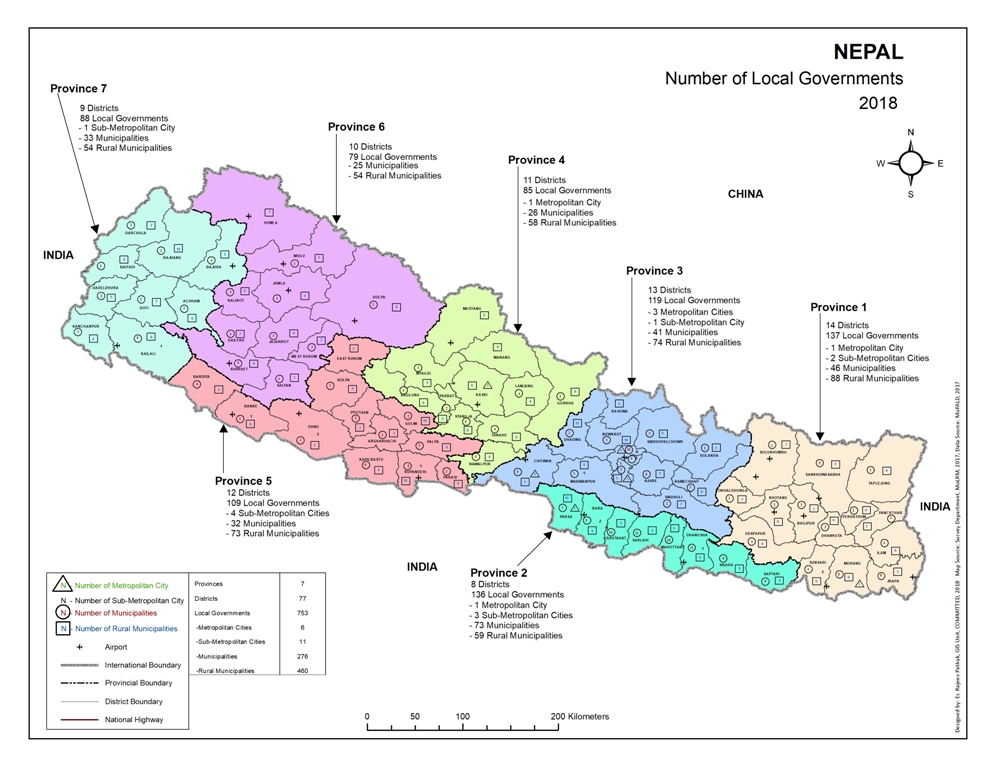
Click here to read a blog post about COMMITTED producing Map of Local Governments.
Click here to go to a Facebook post of Municipal Round Table Discussion.
Click here to go to a Facebook post of the visit to remaining municipalities.
Click here to read a blog about EnLoG-SDEG.